


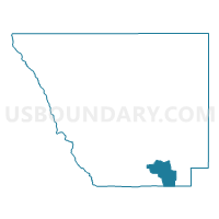
Larimer 418, Larimer County, Colorado
About
Outline

Summary
| Unique Area Identifier | 548803 |
| Name | Larimer 418 |
| County | Larimer County |
| State | Colorado |
| Area (square miles) | 47.94 |
| Land Area (square miles) | 45.79 |
| Water Area (square miles) | 2.15 |
| % of Land Area | 95.51 |
| % of Water Area | 4.49 |
| Latitude of the Internal Point | 40.31308220 |
| Longtitude of the Internal Point | -105.23018860 |
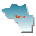
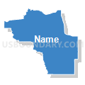
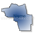
Maps


Graphs
Select a template below for downloading or customizing gragh for Larimer 418, Larimer County, Colorado


Neighbors
Neighoring Voting District (by Name) Neighboring Voting District on the Map
- Boulder 232, Boulder County, CO
- Boulder 233, Boulder County, CO
- Boulder 4, Boulder County, CO
- Larimer 410, Larimer County, CO
- Larimer 417, Larimer County, CO
- Larimer 419, Larimer County, CO
- Larimer 424, Larimer County, CO
- Larimer 512, Larimer County, CO
Top 10 Neighboring County Subdivision (by Population) Neighboring County Subdivision on the Map
- Longmont CCD, Boulder County, CO (99,942)
- Loveland CCD, Larimer County, CO (95,583)
- Berthoud CCD, Larimer County, CO (11,509)
- Estes Park CCD, Larimer County, CO (11,309)
Top 10 Neighboring Unified School District (by Population) Neighboring Unified School District on the Map
- St. Vrain Valley School District RE 1J, CO (151,981)
- Thompson School District R-2J, CO (104,236)
- Park School District R-3, CO (11,493)
Top 10 Neighboring State Legislative District Lower Chamber (by Population) Neighboring State Legislative District Lower Chamber on the Map
- State House District 49, CO (83,740)
- State House District 51, CO (80,253)
- State House District 13, CO (69,892)
Top 10 Neighboring State Legislative District Upper Chamber (by Population) Neighboring State Legislative District Upper Chamber on the Map
- State Senate District 15, CO (155,929)
- State Senate District 16, CO (136,132)
- State Senate District 18, CO (122,287)
Top 10 Neighboring 111th Congressional District (by Population) Neighboring 111th Congressional District on the Map
Top 10 Neighboring Census Tract (by Population) Neighboring Census Tract on the Map
- Census Tract 26, Larimer County, CO (6,317)
- Census Tract 18.08, Larimer County, CO (4,707)
- Census Tract 136.01, Boulder County, CO (3,831)
- Census Tract 19.03, Larimer County, CO (3,765)
- Census Tract 20.10, Larimer County, CO (2,518)
- Census Tract 132.01, Boulder County, CO (1,531)